Actis 7 WiFi Europe Truck
Navigation device ACTIS 7 with preinstalled navigation software for large vehicles Pocket Navigator 11 Truck with 3 years free map upgrades.
Big 7 inch hi-resolution display , dual core processor, WiFi
More than just a navigation.
- Truck Mode
-
- Route optimisation for large vehicles based on vehicle height and weight
- Avoid low bridges and narrow lanes
-
Big 7 inch hi-resolution display
-
Dual core processor
-
WiFi
-
Support for an external TMC reciever (traffic information)
-
Possibility to connect it with a rear camera
-
Audio/Video input and output
-
Multitasking for using more applications simultaneously
-
USB host port for connection with another devices
-
The integration into more sophisticated logistics systems can be realized by one connector which includes a power supply and 2 serial ports.
-
You can run your application for WinCE 6.0 under the button CUSTOMER
-
WinCE 5.0 in Actis7 contains .NET 3.Your Application can run with Navigator simultaneously. You can switch between the Applications with the Hardware buttons or with TCP/IP commands
-
Navigator can be integrated with other programs with a number of external commands. These can be sent to Navigator via serial interface or TCP / IP. So you can resize the Navigator window, change various settings, send new routing points or communicate with the driver similar to ICQ and many others. You can also obtain information from Navigator, e.g. remaining time or distance to destination, current coordinates, and many others.
-
The list of current commands can be found here.
-
Other modifications in Navigator can be done by changing the configuration files. Buttons may be removed from the menu or may be added to the map/navigation screen.
-
Modification of roads parameters
-
Detailed road types set preferences for searching of optimal routes
-
Warnig for speeding
-
Airplane mode (off-road)
-
Extended TCP/IP commands for remote communication or communication between 2 softwares (dispatcher can chat with conductor or can send him new destination, etc. using our VehicleTruckUnit)
- Voice guidance
-
Intuitive voice navigation in different languages
-
Door to door route planning
-
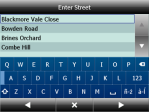
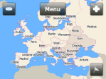
Cross-border routing without the need to switch between countries or to a less detailed map
-
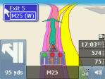
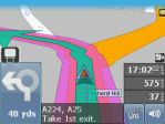
Overview of the upcoming manoeuvre and its distance
-
ETA to your destination
- GPS satellite navigation
-
Assistant for traffic lines shifting
-
2D/3D mode allows realistic visual map display
-
Day/night modes switch colour schemes for day or night time driving
-
Map rotates in driving direction, or north up
- Searching
-
Find nearest points of interest
-
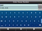
Postcodes
-
Full GB postcodes (1.8 million)
- Speed cameras
-
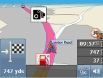
Hear audible warnings as you approach speed cameras
- Special features
-
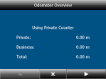
Odometer keeps a track of private and business mileage
-
Routing modes for car, pedestrian, truck
-
Optimization of the order of waypoints
-
Add your own favourites
-
Direct import of your own favourites databases from xls, dbf, Access, ArcInfo, MapfInfo files or another ODBC sources
-
Route avoidance - block off certain road from your route
-
Multitasking for using more applications simultaneously
-
Real 3D icons of important landmarks
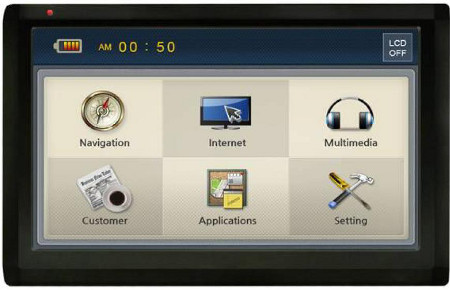
Navigation device ACTIS 7 with preinstalled navigation software Pocket Navigator 11 is a modern navigation which also offers applications for spare time: audio and video player, photo viewer, calculator and notepad.
At the same time, it can be connected to the Internet thanks to integrated WiFi antenna and used for searching relevant information, accessing to e-mail address, having fun etc.
Actis 7 WIFI also means:
Actis 7 also supports remote TCP/IP messaging through our vehicle tracking unit VTU 10. You can send text messages, assign new destinations from your dispatching central, etc.
Your Application in Actis 7
Integration into superiour telematic systems
Features
Basic features
Physical Attributes |
|
| Dimensions in millimetres: | 182 x 115 x 21 (width x height x depth) |
| Weight: | 410g |
Processor and Memory |
|
| CPU: | Telechips TCC8803 Dual Core 2,12GHZ (1,12GHz core + 1GHz dsp) |
| ROM size: | 256MB NAND Flash |
| RAM size: | 512MB DDR2 |
| OS: | MS Windows CE.NET 6.0 core |
Graphical subsystem |
|
| Display: | Digital TFT Touch screen LCD |
| Colordepth: | 24 bit full color |
| Resolution: | 800 x 480 WVGA |
| Diagonal: | 7 inches |
| Brightness | 400 cd/m |
Audio subsystem |
|
| Speaker: | 1,5 W (built-in) 36 π (Stereo) x 2 |
| Audio Output: | 3.5mm, stereo |
Interfaces |
|
| Positioning Device: | Touchscreen |
| Expansion Slots: | MMC, SD |
| USB Connector: | USB 2.0 host |
| IR receiver | IR remote control |
| GPS Module: | UBLOX 6 |
| Serial Port: | RS 232, TTL |
Power Supply |
|
| Power: | 12V/14V 1.5 A (side 1port, bottom 1port) |
| Battery: | 1600mAH Li-polymer (2hours running) |
Multimedia |
|
| Video player: | Codec format : MPEG-1/2/4, H.263, H.264 File format :3GP, MP4, AVI, MKV, MPG, M2TS, TS/TP, FLV |
| Audio player: | Codec format : MP2, MP3, MIDI, OGG, AAC, WAV, FLAC, BSAC, DTS File format : Ogg Media (*.ogg) / MP3 (*.mp3) / WAV |
| Photo viewer | JPG, JPEG, PNG, BMP,GIF |
| [Note]: | Because of codec licensing some files may not play. |
Extra |
|
| TMC: | Supports external TMC receiver |
| AV in: | for external source |
| AV out: | Dual display (optional) |
| Rear Camera: | Input for Rear camera |
| WiFi: | 802.11/b/g/n |
Truck Attribute Coverage
| Major Roads | Interconnecting Roads | Street Network |
| Austria,
Belgium, Czech Republic, Denmark, Estonia, Finland, France, Germany, Greece, Italy, Latvia, Lithuania, Luxembourg, Netherlands, Norway, Slovakia, Slovenia, Sweden, Switzerland, United Kingdom |
Belgium
, Germany, Luxemburg, Netherlands, Switzerland, United Kingdom |
United Kingdom |
Map Coverage
| STNW | ICNW | MRNW | |
|---|---|---|---|
| Austria | 100 | 100 | 100 |
| Belgium | 100 | 100 | 100 |
| Bulgaria | 53 | 100 | 100 |
| Croatia | 50 | 100 | 100 |
| Czech Republic | 100 | 100 | 100 |
| Denmark | 100 | 100 | 100 |
| Estonia | 100 | 100 | 100 |
| Finland | 100 | 100 | 100 |
| France | 100 | 100 | 100 |
| Germany | 100 | 100 | 100 |
| Great Britain inc NIRL, Isle of Man and Channel Islands | 100 | 100 | 100 |
| Greece | 88 | 100 | 100 |
| Hungary | 100 | 100 | 100 |
| Italy | 100 | 100 | 100 |
| Ireland | 100 | 100 | 100 |
| Latvia | 63 | 100 | 100 |
| Lithuania | 100 | 100 | 100 |
| Luxemburg | 100 | 100 | 100 |
| Malta | 100 | 100 | 100 |
| The Netherlands | 100 | 100 | 100 |
| Norway | 100 | 100 | 100 |
| Poland | 70 |
100 | 100 |
| Portugal | 100 | 100 | 100 |
| Romania | 13 | 13 | 100 |
| Slovakia | 100 | 100 | 100 |
| Slovenia | 100 | 100 | 100 |
| Spain | 100 | 100 | 100 |
| Sweden | 100 | 100 | 100 |
| Switzerland | 100 | 100 | 100 |
| Turkey | 64 | 84 | 100 |
| Ukraine | 38 | 100 | 100 |
| Albania | Only connection network | ||
| Belarus | Only connection network | ||
| Bosnia Herzegowina | Only connection network | ||
| Macedonia | Only connection network | ||
| Moldavia | Only connection network | ||
| Serbia Montenegro | Only connection network | ||
STNW = fully attributed street network
ICNW = interconnecting network
MRNW = major road network
Map of Russia is also available for extra purchase.
STNW = fully attributed street network
ICNW = interconnecting network
MRNW = major road network
Map of Russia is also available for extra purchase.

