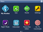
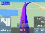
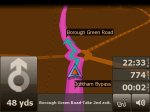
Navigator 10 - Great Britain and Ireland
Navigation software for PCs and Windows Mobile devices with voice guidance and detailed map of Great Britain and Ireland
includes Isle of Man and the Channel Islands
New in Navigator 11
- Voice guidance
-
- intuitive voice navigation in different languages
- door to door route planning
- cross-border routing without the need to switch between countries or to a less detailed map
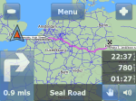
- overview of the upcoming manoeuvre and distance shown on the screen
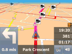
- Traffic lane assistant
- Motorway Signs – clear signs which show the direction of travel
- Real 3D icons of important landmarks
- GPS satellite navigation
-
- 2D/3D mode allows realistic visual map display
- day/night modes switch colour schemes for day or night time driving
- map rotates in driving direction, or north up
- Searching
-
- find nearest points of interest
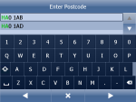
- postcodes
- full GB postcodes (1.8 million)
- Speed cameras
-
- hear audible warnings as you approach speed cameras
- Features
-
- odometer keeps a track of private and business mileage
- add your own favourites
- organise your favourites into different categories
- TMC - real-time traffic informations
- routing modes for car, pedestrian, truck
- route avoidance - block off certain road from your route
- import your databases into the map
- import directly from xls, dbf and access files with utilities provided
- Remote TCP/IP commands
-
- 2 way communication between driver and dispatcher
- PDA Vehicle Tracking
- works with our VTU only
- track your vehicles remotely on a PDA
- keep your vehicles under control and reduce costs
- efficient tool for tracking and managing of your vehicles wherever you are
- Integration into larger telematic systems.
-
- Navigator can integrate with other programs with a number of external commands. These can be sent to Navigator via a serial interface or TCP / IP. So you can resize the Navigator window, change various settings, send new routing points or communicate with the driver similar to ICQ and many others. You can also obtain information from Navigator, f.e. remaining time or distance to destination, current coordinates, and others.
- The list of current commands can be found here.
- Other modifications in Navigator can be done by changing the configuration files. Buttons may be removed from the menu, or vice versa buttons can be added to the map/navigation screen.
| STNW | ICNW | MRNW | |
|---|---|---|---|
| Great Britain inc NIRL, Isle of Man and Channel Islands | 100 | 100 | 100 |
| Ireland | 100 | 100 | 100 |
System Requirements
PC Navigator 11
- Windows 2000/XP/Vista/7
- 0.5 GB free hard disc space for complete installation of Europe
Pocket Navigator 11
- PDA with Pocket PC 2003 or later, Windows Mobile
- memory card (0.5 GB for complete Europe instalation)
- touchscreen (VGA, QVGA, 240x240 px)
Navigator on Linux and Mac OS X
- Under Linux install under WINE (www.winehq.org)
For USB GPS (which mounts on /dev/ttyACMO) create link:
~/.wine/dosdevices$ ln -s /dev/ttyACM0 com1
Tested on Ubuntu 10.04, wine 1.1.42, GPS BR 355 (usb), PC Navigator 10 (10.0.51)
- Under Mac OS X install under WINE (http://darwine.sourceforge.net/) Install windows font with TRiX, part of Darwine.
For USB GPS (which mounts on /dev/ttyACMO) create link:
~/.wine/dosdevices$ ln -s /dev/ttyACM0 com1
Tested on Mac OS X xxx, wine xxx, GPS BR 355 (usb), PC Navigator 10 (10.0.51)

