Navigator 10 - Europe
Navigation software for PCs and Windows Mobile devices with voice guidance and detailed map of Europe.
New in Navigator 10
Voice guidance
- Intuitive voice navigation in different languages
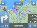
- Door to door route planning across Europe
- Cross-border routing without the need to switch between countries or to a less detailed map
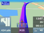
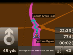
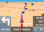
- Overview of the upcoming manoeuvre and distance shown on the screen
- Traffic lane assistant
- Motorway Signs – clear signs which show the direction of travel
- Real 3D icons of important landmarks
GPS satellite navigation
- 2D/3D allows realistic visual map display
- Day/night modes switch colour schemes for day or night time driving
Searching
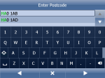
- New user friendly search interface
- Searchable index of 8 379 000 streets with house numbers
- Over 1 753 000 POIs
- Find nearest points of interest
- Postcodes for Europe (in most countries)
- Full GB postcodes (1.8 million)
Speed cameras
- Hear audible warnings as you approach speed cameras
Features
- Odometer keeps a track of private and business mileage
- Add your own favourites
- Import your databases into the map directly from xls, dbf, Access, ArcInfo, MapInfo files and other ODBC sources
- TMC – real-time traffic information – bypass traffic jams and road-works
- Route avoidance – block off certain roads from your route
- Routing modes (different types of vehicle or pedestrian)
- remote TCP/IP commands – advanced 2 way communication between driver and dispatcher
Vehicle Tracking
works with our VTU devices only
- Track your vehicles remotely
- Keep your vehicles under control and reduce costs
- Efficient tool for tracking and managing your vehicles wherever you are
Coverage
| STNW | ICNW | MRNW | |
|---|---|---|---|
| Austria | 100 | 100 | 100 |
| Belgium | 100 | 100 | 100 |
| Bulgaria | 53 | 100 | 100 |
| Croatia | 50 | 100 | 100 |
| Czech Republic | 100 | 100 | 100 |
| Denmark | 100 | 100 | 100 |
| Estonia | 100 | 100 | 100 |
| Finland | 100 | 100 | 100 |
| France | 100 | 100 | 100 |
| Germany | 100 | 100 | 100 |
| Great Britain inc NIRL, Isle of Man and Channel Islands | 100 | 100 | 100 |
| Greece | 88 | 100 | 100 |
| Hungary | 100 | 100 | 100 |
| Italy | 100 | 100 | 100 |
| Ireland | 100 | 100 | 100 |
| Latvia | 63 | 100 | 100 |
| Lithuania | 100 | 100 | 100 |
| Luxemburg | 100 | 100 | 100 |
| Malta | 100 | 100 | 100 |
| The Netherlands | 100 | 100 | 100 |
| Norway | 100 | 100 | 100 |
| Poland | 70 |
100 | 100 |
| Portugal | 100 | 100 | 100 |
| Romania | 13 | 13 | 100 |
| Slovakia | 100 | 100 | 100 |
| Slovenia | 100 | 100 | 100 |
| Spain | 100 | 100 | 100 |
| Sweden | 100 | 100 | 100 |
| Switzerland | 100 | 100 | 100 |
| Turkey | 64 | 84 | 100 |
| Ukraine | 38 | 100 | 100 |
| Albania | Only connection network | ||
| Belarus | Only connection network | ||
| Bosnia Herzegowina | Only connection network | ||
| Macedonia | Only connection network | ||
| Moldavia | Only connection network | ||
| Serbia Montenegro | Only connection network | ||
STNW = fully attributed street network
ICNW = interconnecting network
MRNW = major road network
Map of Russia is also available for extra purchase.
STNW = fully attributed street network
ICNW = interconnecting network
MRNW = major road network
Map of Russia is also available for extra purchase.
System Requirements
- 2.5 GB of free hard disc space required for complete installation
- touchscreen
- Memory card (2.2 GB for complete installation
- countries/regions can be installed individually or in groups

